Background
Compared to other regions of the world, Latin America and the Caribbean has historically made a minor contribution to climate change. Nonetheless, the region is acutely vulnerable to its negative consequences. Suriname is no exception. It has already experienced extensive coastal erosion and has suffered damages from heavy rainfall, flooding and higher temperatures during dry seasons and high winds.
So far, the global focus on measuring GHG emissions has not provided much support to better measure climate change occurrences, impacts (including damages and losses), and adaptation indicators, which remain the most relevant issues for the Caribbean. The United Nation’s Development Account 12 project “Caribbean relevant climate change and disasters indicators for evidence-based sustainable development policies” aims to strengthen resilience to climate change and disasters by enhancing the production and use of selected, relevant, and prioritized indicators.
The Republic of Suriname is highly committed to playing its part in the global fight against climate change. It has presented two Nationally Determined Contributions (NDCs), one in 2015 and the second one in 2020. NDCs in Suriname have created synergies and improved the buy-in among stakeholders for climate action. Furthermore, the alignment between the Policy Development Plan 2017 – 2021 with the latest NDC has opened a comprehensive package of policies essential to achieve the NDC ambition. However, putting those policies into practice requires quality data and indicators to assess their impact and monitor their implementation.
Over the past two decades, Suriname has worked hard to provide quality environment statistics and indicators. Suriname´s efforts in creating a solid national system to provide quality information on the status of the environment materialized with the promulgation of the Environment Act. The Act enables the National Environment Authority (NMA) to designate government agencies to provide information relevant for protecting the environment. In 2017, Suriname installed the Suriname National Environmental Information Network (SMIN), a consortium of trustworthy entities, including NMA, the General Bureau of Statistics (GBS) and the Foundation for Forest Management and Production Control (SBB) that have access to environmental data, information, and statistics. And in 2020, GBS published the 9th Environment Statistics Publication 2015 – 2019[1], a comprehensive compilation of environment statistics relevant for the country presented in figures, graphs, and tables. Besides, in this publication, extra attention is devoted to climate change. Suriname is also part of UNSD’s Expert Group Meeting on Environment Statistics (EGES), contributed to the Global Framework on Climate Change Indicators and Statistics and uses the Framework for the Development of Environment Statistics (FDES), the CARICOM core list and the Sustainable Development Goals (SDGs) as guidelines for the Environment statistics publication.
Despite having the mechanisms in place to access environmental data, the complexity of climate change and disasters statistics and indicators poses several challenges in Suriname to produce the necessary indicators to guide decision making. There is a need to build indicators on each of the critical areas to fight climate change, such as drivers, impacts, vulnerability, mitigation, and adaptation. Further, training on metadata and data collection for climate change and disasters indicators are required for various national stakeholders.
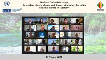
Against this backdrop, The Economic Commission for Latin America and the Caribbean (ECLAC) and the General Bureau of Statistics (GBS) of Suriname have decided, in the framework of the Development Account 12 project, to organize the national online workshop: Generating climate change and disasters indicators for policy decision-making in Suriname.
Objectives
- Train the participants to build selected environment, climate change and disaster indicators and its metadata.
- Identify data and capacity gaps to build an information platform on resilience for the country (statistics and geospatial data).
- Have a better understanding of how geospatial data can enhance the use of environment, climate change and disaster indicators for effective decision making.
Expected outcomes
- At least five prioritized climate change or disasters indicator and its metadata is available at the end of the workshop.
- A list of relevant and prioritized climate change and disasters indicators for Suriname that are also linked to the Paris Agreement and the Global Framework on Climate Change Indicators and Statistics of the UNSD.
- A work plan to build selected prioritized climate change and disasters indicators and statistics is agreed with GBS and key stakeholders.
Connection details, date, and hours
- Via Zoom, link provided to registered participants
- Date: 13 to 15 July
- Initial Hour: 10:00 A.M. (Suriname time) / 09:00 A.M. (Santiago time)
- Final Hour: 12:00 P.M. (Suriname time) / 11:00 A.M. (Santiago time)
[1] https://statistics-suriname.org/wp-content/uploads/2021/03/Final-9th-environment-pub-2020.pdf
________________________________________________________________________
Presentations and Agenda click HERE
Framework for the Development of Environment Statistics (FDES) HERE
Programa
